
An official website of the United States government
The .gov means it’s official. Federal government websites often end in .gov or .mil. Before sharing sensitive information, make sure you’re on a federal government site.
The site is secure. The https:// ensures that you are connecting to the official website and that any information you provide is encrypted and transmitted securely.
- Publications
- Account settings
Preview improvements coming to the PMC website in October 2024. Learn More or Try it out now .
- Advanced Search
- Journal List
- v.8(6); 2022 Jun

Evaluation of the hydrocarbon source rock and the reservoir characterization of the Minagish Formation using wireline logs
Associated data.
The data that has been used is confidential.
We investigated the Mianagish Formation's potentiality as a Lower Cretaceous source rock and the included reservoir facies zone in the Umm Gudair oil field. The Middle Oolitic grainstone is the only producing zone in the formation. The wireline logs were used to trace the reservoir characteristics and calculate the total percentage of organic carbon (TOC) in the lithotype of the Minagish Formation. The commercial software, thin sections, and laboratory measurements are used to provide an integrated study. Integration of burial history, calculated TOC values, thermal maturity, depositional model, structural elements, and reservoir characterization were used to take a thoughtful look at the Minagish Formation's role in oil production in the field and as Lower Cretaceous source rock for the Cretaceous reservoirs. The reservoir facies are characterized by 16% average clay content, 16.7% average porosity, 420 millidarcys (mD) average permeability, and the average oil saturation is about 62%. The reservoir's quality reaches its maximum at the crest of the anticline in the west, south, and east, whereas the reservoir facies are deposited on the pre-existing structurally high shoal, while the quality decrease away from the shoal into the relatively deep water. The oil feeds the reservoir from the Lower Minagish Formation and maybe the Sulaiy Formation. According to the thermal model, the oil is heavy because of falling the TOC in the early maturation stage. The depositional environment and sequence stratigraphy are similar in the nearby Dharif and Abduliyah oil fields, and the study can be applied.
Middle/Oolitic Minagish reservoir; log-derived TOC; Umm Gudair oil field; heavy oil; shoal depositional environment.
1. Introduction
Understanding the petroleum system elements and processes correctly in time and place lead to massive oil and gas exploration and enhances development opportunities. Also, the understanding of the reservoir characteristics is essential to evaluate the oil-in-place and producibility. In most cases, when the source rocks are heated to a particular temperature due to deep burial, they tend to release hydrocarbons that depend on the type of organic matter in the source rock ( Meyer and Nederlof, 1984 ). The quality and quantity of organic matter in the source rock and their maturity are usually determined by chemical and microscopic analysis in the laboratory from the core samples ( Zhao et al., 2016 , 2017 ; Baouche et al., 2020 ; Sen and Dey, 2019 ). However, in most cases, the core samples are taken as a favor at certain reservoir zones, and analysis of large sets of samples may be time-consuming and costly ( Zhao et al., 2016 ). On the other hand, the wireline logs are the most available data for the complete log in many hydrocarbon wells. Therefore, it is essential to investigate the relationship between source rocks and the wireline logs. This relationship relates to changing the physical properties of the organic matter from those of the surrounding minerals ( Kamali and Mirshady, 2004 ). Passay et al. (1990) developed the "ΔlogR" technique to calculate the total organic carbon (TOC) in source rock using wireline logs. This technique has been calibrated and confirmed over the last decades by many such as Zheng et al. (2021) , Aziz et al. (2020) , Shalaby et al. (2019) , Zhao et al. (2016) , and Kamali and Mirshady (2004) .
Kuwait's stratigraphic section has a thickness range between 23,000 and 27,000 ft and comprises three petroleum systems: The Paleozoic petroleum system, the Jurassic petroleum system, and the Cretaceous petroleum system. However, only the Jurassic and the Cretaceous petroleum systems contribute to production ( Al-khamiss et al., 2009 ). Gotnia Formation is a thick layer of evaporites (∼200 m) which is considered a Late Jurassic seal that separates the Jurassic and Cretaceous petroleum systems ( Fox and Ahlbrandt, 2002 ). The hydrocarbons are producing unconventionally from the Late Jurassic Sargelu, Najmah, and Marrat formations, while the Cretaceous petroleum system comprises all the petroleum system elements ( Stern and Johnson, 2010 ; Jassim and Goff, 2006 ). The Upper Tithonian–Lower Berriasian Sulaiy and the Berriasian Minagish are considered the source rocks of the high potential Cretaceous reservoirs such as Zubair, Burgan, Mauddud, Wara, Ahmadi, and Mishrif formations.
As a U-shape, the Umm Gudair Field lies in West Kuwait near the Saudi Arabian border with 172.6 km 2 ( Figure 1 A). The field is divided into the western Umm Gudair sector, the eastern Umm Gudair sector, and the southern Umm Gudair sector ( Figure 1 B). The Minagish Oolite/Middle member of the Minagish Formation has moderate to high porosity, is hydrocarbon-bearing, and is considered the main contributor of hydrocarbon production in the Umm Gudair Field ( Arasu et al., 2012 ). The Minagish Formation has been deposited on a broad, prograding carbonate, has a thickness range from 160 m in Burgan Field in the south to 360 m in the northern fields, and has three members. Only the Middle/Oolitic Member is a reservoir composed of fine-grained, bioturbated, and peloidal lime packstones based on the Lower Member ( El Gezeery et al., 2007 ) ( Figure 2 ). The upper part lithofacies is mainly peloidal wackestones-grainstones, packstone, and mudstone. The reservoir has been suggested to be heterogeneous because of the rapid decline pressure of many wells that have been tested to date, with relatively low productivity ( Thomas, 2007 ; Zittel et al., 2008 ).

A) A) Map showing the location of the Umm Gudair oil field in Kuwait, B) Base map showing the location of the wells that have been used in this study.

The stratigraphic column of Kuwait (after Abdulla et al., 1997 ), enlarged are the Lower Cretaceous Miagish and Sulaiy Formations with two thin sections A and B taken from Upper and Middle Minagish Formation; section A) Wackestone with intercrystalline or vuggy pores, occluded by microcrystalline calcite cement. B) Close-up images showing the filling of porosity by sparry calcite rhombs (yellow arrows) or occasionally halite (red arrows).
The above studies and many more have demonstrated the importance of the Minagish Formation as a potential source rock and reservoir. However, it is challenging to find core samples representing the complete stratigraphic units of the Minagish and Sulaiy formations. Therefore, this study aims to investigate the zones saturated by TOC and their maturity in the Minagish and Sulaiy formations using the wireline log and core samples. Another aim of this study is finding the reservoir zone and estimating its petrophysical characteristics and heterogeneities.
2. General geology
The Minagish Formation has been deposited on a broad, shallow intra-shelf to an inner mid-ramp environment of the passive margin of the Arabian Plate and the Neo-Tethys Ocean ( Alsharhan and Naim, 1997 ). It is Berriasian-Valanginian in age and is divided into three members: Upper, Middle, and Lower Member. The Lower Minagish Member is a low permeability dolomitized section and dense limestone with marls, while the Upper Minagish Member comprises wackestones-grainstones and is considered the seal to the productive Minagish Oolite/Middle Member ( Figure 2 A) ( Rahaman et al., 2012 ). The Minagish Oolitic is equivalent to the Ratawi Oolite of the Wafra Field and the Yamama Formation of Southern Iraq and comprises coarse-grained Oolitic grainstones and packstones with inter-crystalline or vuggy pores ( Figure 2 B). The Minagish Formation is overlined by the Ratawi Limestone reservoir of around 100 m and is underlain by the about 150 m Sulaiy source rock ( Figure 2 ). The Late Jurassic and the Early Cretaceous Age's Minagish and Sulaiy formations are considered the primary source rocks of the Cretaceous reservoirs where the oil expelled to the Cretaceous reservoirs ( Abdullah et al., 1997 ). These source rocks have kerogen Type II and were deposited in carbonate-rich, marine anoxic conditions during the Late Jurassic to Early Cretaceous time ( Abeed et al., 2011 ). Its vitrinite reflectance (Ro) ranges between 0.52% and 0.70% and is still in the oil window after expelling 70% of the movable hydrocarbon since 60 Ma ( Al-Khamiss et al., 2009 ).
The Minagish Formation is affected by Jurassic, Cretaceous, and late Tertiary structure development phases ( Carmen, 1996 ); the main elements in Umm Gudair Field are folding and Late Cretaceous faulting. It consists of two elongated anticline structures, an east-south anticline and a west anticline, connected in a U-shape ( Adasani, 1985 ). The Minagish Formation is affected by the tectonic events of the Cretaceous age: the break-up due to the drifting of India from Gondwanaland since 150 Ma, the subduction zone initiated from moving the Arabian Plate towards Eurasia since 130 Ma, and the ophiolite obduction onto the Arabian Margin between 80 and 90 Ma ( Aladwani, 2021a ; Harland et al., 1989 ). A set of anticlines appear on the gravity anomalies depth map ( Figure 3 ), which is calculated by the Source Parameter Imaging (SPI) module in Geosoft® software ( Aladwani, 2021b ). These anticlines represent the trap in Al Ahmadi and Wafra oil field in the south of Umm Gudair oil field, Minagish and Abduliyah oil field in the north of Umm Gudair field.

Bouguer anomalies depth map generated from Source Parameter Imaging (SPI) module in Geosoft® software shows the anticlines structure in Umm Gudair Field and nearby Minagish oil field.
3. Method and materials
3.1. reservoir characterizations.
This study used 14 wells: nine wells on the eastern anticline, three wells on the elongated western anticline, and two wells on the saddle. All wells have gamma-ray (GR), resistivity (Rt), density (ρb), neutron (ФN), and sonic (ΔT) logs. Three wells, UGSE-3, UGNW-2, and UGSE-6, reach the Lower Minagish Member and are used for Log-driving TOC of the Minagish Formation. The commercial software package (TechLog® and PetroMode®) was used to identify reservoir zones and estimated clay percentage, porosity, permeability, water saturation, and hydrocarbon saturation. Also, it is used to investigate the burial history, temperature, and thermal maturity.
We calculated the volume of shale (V sh ) for the Oolitic grainstone of the Middle Minagish from the GR-log using Eq. (1) and confirmed the results from Neutron-Density logs.
Where IGR is the index of gamma-ray, which is calculated by Eq. (2) ( Schlumberger, 1974 ):
GR Log is the reading of the GR log in the reservoir formation, GR min is the minimum reading of the GRlog in front of clean sand, and GR max is the maximum reading of the GR-log at shale lithology.
The porosity was calculated from the neutron and bulk density log (ρ b ) using the Eq. (3) of Tiab and Donaldson (1996) and Eq. (4) of Wyllie et al. (1958) , respectively.
Where ФN corr is the corrected porosity for clean rock from shale and ФN sh is the neutron porosity value for shale.
Where ρ ma is the density of the matrix, ρ b is the bulk density measured from the log, and ρ f is the fluid density.
Then, the effective porosity (Ф e ) is calculated by the Eq. (5) of Schlumberger (1998) after correcting the total porosity from the shale effect.
Where Ф e is effective porosity, and Ф t is total porosity.
The water saturation was calculated from Archie's equation (1952) , equation number (6).
Where Sw is water saturation, Fm is the formation factor (=1/Ф m ), R w is derived from the value of the deep resistivity log in front of the pure water-saturated zone around the reservoir, Rt is observed deep resistivity, and (a, b, and c) are Archie's coefficients equal (1, 2, and 2, respectively).
The empirical Eq. (7) has been proposed by Wyllie and Rose (1950) and modified by Carman (1937) to calculate the permeability of the reservoirs.
where K is permeability in millidarcy (mD), Ф is porosity, and S wir is irreducible water saturation. The irreducible water saturation is the amount of water in the oil zone and is calculated from Eq. (8) .
Where V cl is the volume of shale and C is Buckles's constant.
3.2. Petrographic analysis
Two thin sections have been taken, with a thickness range from 20 microns to 1000 microns, from core plugs in the Middle and Lower Minagish Formation to describe the grain size, sort, and packing. These thin sections were under a Scanning Electron Microscope (SEM) and showed us the types and distribution of microporosity in the carbonate ( Figure 2 ). The JEOL SEM (Carryscope: Model JCM 5700) which characterized by 5 nm resolution has been used to carry out this analysis. The SEM can investigate the inner structure visualization using micro-CT and the microporosity distribution by providing us with three-dimensional images obtained using stereo mode.
3.3. Log-derived TOC and thermal maturity
This work investigated the Minagish Formation's potentiality as a source in well UGNW-3, UGNW-2, UGSE-3, and UGSE-6 in the study area penetrating the Minagish Sulaiy formations. ΔlogR technique of Passey et al. (1990) has been used to identify organic-rich intervals, including sonic/resistivity, neutron/resistivity, and density/resistivity overlays ( Figure 4 ). This method requires an overlay of appropriately scaled sonic, neutron, and density logs on a resistivity curve using some empirical Eqs. (9 , 10 , and 11 ):
Where Δ log R is the curve separation measured in the logarithmic resistivity cycle. The value of Δ log R is calculated essentially from sonic/resistivity logs, confirming the results from neutron/resistivity and density/resistivity logs. The separation value “Δ log R” at a specific zone reflects the saturation of that zone by organic matters.

A Layout shows the log-derived TOC for well UHNW-3 using the Passey et al. (1990) method of sonic/resistivity, neutron/resistivity, and density/resistivity overlays and the calculated Δ log R separation.
R is the resistivity (ohm-m) measured by the resistivity logging tool. The ADR™ Azimuthal Deep Resistivity tool developed by Halliburton Company has been used in well logging.
R baseline is the resistivity corresponding to the Δt baseline .
ՓN baseline and ρb baseline are curve values for non-source rock lithology, clay-rich rocks.
Δt is the measured transit-time in msec/ft.
ՓN is the measured neutron porosity scaled in the fraction unit.
ρ b is the measured bulk density in g/cm 3 .
The Δ Log R separation is linearly related to the TOC and is a function of maturity. The TOC in organic-rich rocks can be derived from Δ Log R by the Eq. (12) :
LOM (Level of Organic Metamorphism) is estimated from the burial history, thermal history, and the cross-plot between the maximum temperature (T max ) and effective heating time (T eff ) ( Diab and Khalil, 2021 ; Mohamed et al., 2016 ; Hood et al., 1975 ; Passey et al., 1990 ). First, the burial history model was built using the Petromode® software, and then the LOM was derived from it by plotting the relationship between the effective heating time (T eff ) versus the maximum temperature (T max ). This model has been calibrated by the vitrinite reflectance (R o ) model developed by Burnham et al. (2017) .
4.1. Thermal maturity hydrocarbon potentiality
We investigated the source rock potentiality of the Minagish Formation rocks and the underlying Sulaiy formations from the deep wells at the eastern and southern anticlines (UGSE-3 and UGSE-6) and the western anticline (UGNW-2 and UGNW-3). The deep wells' depth reaches 15,750 ft and penetrates the Lower Minagish and Sulaiy Members. The log-derived TOC from well UGNW-3 ( Figure 5 A) shows high correlation values with the laboratory measurement TOC ( Table 1 ) for Oolitic Minagish Formation. The well UGNW-2 penetrates the anhydrite of the Hith Formation at 13,000 ft depth, while the Minagish Oolitic reservoir depth ranges between 8,000 and 10,750 ft. The log-derived TOC values ( Figure 5 B) range between less than 1 wt.% and 6.9 wt.% in the Middle Minagish Member; however, the most values condensed down to 2 wt.% ( Figure 5 B). The LOM of the Minagish Formation is 9.2, while it is 9.8 for the Sulaiy Formation, which indicates that these formations have entered the oil maturation zone. The thermal maturity model shows that the R o of the Minagish Formation ranges between 0.55% and 0.70%, whereas it lies at the beginning of the heavy oil window ( Figure 6 ). Abdullah and El Gezeery (2016) measured the TOC in core samples from the Minagish Formation in the Umm Gudair field and found that the TOC ranges between 0.99 and 7.9 wt.%. Also, they found that T max does not exceed 423 °C, which indicates immature kerogen or at the early stage of maturation. The log-derived TOC values are well correlated to those measured from the samples and advanced by its deduction from the well logs and coverage of the complete logged sedimentary succession, which ranges between 7,000 and 15,500 ft.

Cross-plot between the log-derived TOC and its depth in A) well UGNW-3 and B) well UGNW-2, showing that the values of the TOC range from less than 1 up to 6.9 wt%, while the total organic matters concentrated mainly in two depth ranges (8,500–10,500 ft) and (12,200–13,000 ft).
Table 1
The results of measured TOC from the studied sample in well UG-NW-3.

The burial history of Umm Gudair field derived from the depositional sequence in the field, calibrated by the vitrinite reflectance (R o ), showing that the Minagish Formation lies in the early stages stage of the oil window.
4.2. Depositional environment
The Minagish Formation is deposited in a shallow marine environment on the inner to middle carbonate ramp with a dominant limestone lithology and a wide range of lithofacies from mudstone to grainstone. The reservoir facies is developed in the formation's Middle/Oolitic Member. It is composed of fine to coarse-grained Oolitic grainstones and packstones with bioclasts. It is interpreted to have been deposited on a pre-existing structural high shoal. This shoal is high and gently sloped away into a deeper environment in all directions from the shoal ( Figure 7 ). The dominant lithotype in the lower part of the Minagish Formation is grainstone, while packstone, wackestone, and mudstone are developed in the upper part ( Figure 7 ) ( Datta et al., 2013 ).

The depositional model of the Minagish Formation in the study area represents a homoclinal ramp extended from the inner ramp to open marine, based on the facies heterogeneity and structural effect of the area (modified from Aghaei et al., 2013 ).
4.3. Sequence stratigraphy
There is a sharp contact which appears on the GR-log between the peloidal wackestone to packstone of the Upper Minagish Member, which is characterized by a Transgressive Systems Tract (TST), and the medium- to coarse-oolitic grainstone of the Middle Minagish member, which is characterized by a Highstand Systems Tract (HST) ( Nath et al., 2014 ; Datta et al., 2013 ) ( Figure 8 ). The Middle Oolitic grainstone is the producing reservoir deposited in a single third-order sea-level cycle and is composed of stacked broadly coarsening parasequences upward due to a high prograding ramp setting ( Nagm et al., 2018 ; Wolpert et al., 2015 ) ( Figure 8 ). There is strong evidence from the GR-log about the changing of the reservoir facies into more argillaceous limestone toward the north of the study area, indicated by the shape and magnitude of the recorded GR ( Figure 9 ). This lateral heterogeneity may be due to changing the water depth laterally into deep water away from the shoal.

Sequence stratigraphy for the deep well (UGNW-2) that penetrate the Minagish, Sulaiy, and Hith Anhydrite Formations.

Wells correlation chart for the wells UGNW-1, UGNW-3, UGSW-1, UGSW-2, UGS, UGSE-7, UGSE-2, UGSE-1, and UGE, was ordered from the northern west and passing through the two anticline arms in the west, the south, and the east.
4.4. Reservoir characterizations
Only Minagish Middle/Oolitic grainstone is the reservoir facies in the Minagish Formation. The reservoir lies at a depth range between 8040 and 9250 ft and is characterized by an overall domal structure in the Umm Gudair oil field. Two elongated anticlines having N-NW direction and NE direction (Figures 9 and and10) 10 ) represent the domed structure. A shallow saddle separates the two anticlines, and each accumulates the oil in the crest. The reservoir has a tarmat 50–100ft thick at the base of the oil column ( El Gezeery et al., 2008 ; Abdullah et al., 2005 ). The reservoir quality is affected by cementation and compaction, whereas the porosity and permeability depend on the leaching of the carbonate grains. The average clay content is 16%, increasing to 30% in the northeast of the field away from the western and southeastern anticlines, whereas the reservoir facies are deposited on a structurally high shoal ( Figure 11 ). The porosity ranges between 12 and 20%, with an average of 16.7%, while the average permeability is 420 millidarcy (mD) and increases at the anticlines' crest to 1200 mD. The hydrocarbon saturation ranges from 37% to 65% in the anticline crests in the west, the south, and the southeast ( Figure 11 ).

The structural elements that affect the Umm Gudair oil field, obtained through structure contour map at the right and its 3D model in the upper left, with two geologic cross-sections: North-South and East-West showing the anticlinal structure in the field.

Petrophysical parameters maps showing the distribution of shale volume (V sh in %), effective porosity (ɸ eff in %), permeability (K in millidarcy, mD), and hydrocarbon saturation (S hc in %) in the Umm Gudair oil field.
5. Discussion
When the structure map of the Minagish Formation is compared to the historical tectonic events of Kuwait, then the anticlines of Umm Gudair, Dharif and Abduliyah areas are interpreted to be related to a regional West Kuwait Arch Lineament called the intra-Jurassic level structures ( Carman, 1996 ). During the Berriasian age, Kuwait was exposed to regional flooding ( Rahaman et al., 2012 ) and became a homoclinic carbonate ramp ( Figure 7 ). Hence, the Minagish Formation was deposited on the pre-existing anticlines as a shoal environment in all these fields. After integrating the depositional environment ( Figure 7 ), wells correlation along with the trap ( Figure 9 ), the structural elements of the Umm Gudair field ( Figure 10 ) with the petrophysical parameters maps ( Figure 11 ), it has been found that the reservoir characterized by lateral heterogeneity. The leading cause of the heterogeneity is related to the structure that affects the shoal. The best reservoir facies quality lies in the anticline area in the west, south, and southeast that was deposited on the shoal. Its quality decreases away from the shoal in all directions, whereas the environment becomes deeper and the clay percent increases, consequently changing the porosity and permeability. Consequently, for the best development plan for the field, we should avoid drilling far away from the crest of the anticlines axis that extends as a U-shape appeared in Figures 1 and 3, 3,9, 9 , ,10, 10 , and and11 11 .
The "ΔlogR" technique estimated the TOC with high accuracy compared to the core samples analysis in the complete lithotype of the Minagish Formation. It is found that the TOC values are concentrated in the Middle Minagish Member and the Sulaiy Formation. The results from this study and others have demonstrated how well logs are related to source rocks. For example, Kamali and Mirshady (2004) quantified the correlation between wireline logs (sonic, density, neutron, and resistivity logs) and total organic carbon using the "ΔLogR" calculation approach. Also, Aziz et al. (2020) estimated TOC using different logs relationship, including the method of "ΔLogR" and found that it is a high accuracy method for identifying the TOC from the wireline logs. In this study, the TOC values are highly comparable with the previous study carried out in this field. However, this study determined the complete zones of high TOC content that otherwise would be difficult to study the complete section through core sampling. In Umm Gudair Field, the hydrocarbon migrates from the rich-TOC member of the Minagish Formation and the underlying Sulaiy Formation to the Middle/Oolitic grainstone Member and is capped by the Upper Member, which composes of wackestone and mudstone.
6. Conclusion
In this study, we have tried to provide an understandable scenario of the oil generation, maturity, and production for the Lower Cretaceous Minagish Formation through the following:
- 1 Deriving the TOC values for the Minagish and Sulaiy Formations using the “ΔLog R″ separation technique from overlaying the sonic/resistivity, neutron/resistivity, and density/resistivity logs of deep wells in the Umm Gudair Field.
- 2 The log-derived TOC values range from less than 1 wt% and up to 6.9 wt% in depth ranges (8,500–10,500 ft) and (12,200–13,000 ft).
- 3 The calculated thermal maturity for the Minagish and Sulaiy formations coincides with the measured values and indicates that the total organic matter is still in the early stage of maturation (heavy oil), which led to the tarmat in the base of the oil column (50–100 ft) in the trap.
- 4 The reservoir facies are the Middle/Oolitic grainstone and has been investigated structurally, petrophysically, and using thin sections. It has been found that the dominant structure is domal and consists of two anticlines elongated in the northwest and the southeast directions.
- 5 The reservoir is characterized by high quality, especially at the crests of the anticlines, whereas the porosity reaches 20%, permeability 1200 mD, and oil saturation reaches 65%.
- 6 The lateral heterogeneity characterizes the reservoir due to the deposition of the reservoir facies on a height shoal.
Declarations
Author contribution statement.
Najeeb S. Aladwani: Conceived and designed the experiments; Performed the experiments; Analyzed and interpreted the data; Contributed reagents, materials, analysis tools or data; Wrote the paper.
Funding statement
This research did not receive any specific grant from funding agencies in the public, commercial, or not-for-profit sectors.
Data availability statement
Declaration of interest's statement.
The authors declare no conflict of interest.
Additional information
No additional information is available for this paper.
- Abdullah F.H., El Gezeery T. Organic geochemical evaluation of hydrocarbons in lower cretaceous middle minagish reservoir, Kuwait. Mar. Petrol. Geol. 2016; 71 :41–54. [ Google Scholar ]
- Abdullah F.H., Carpentier B., Kowalewski I., Van Buchem F., Huc A.Y. Organic matter identification in source and reservoir carbonate in the Lower Cretaceous Mauddud Formation in Kuwait. GeoArabia. 2005; 10 :17–34. [ Google Scholar ]
- Abdullah F.H.A., Nederlof P.J.R., Ormerod M.P., Kinghorn R.R.F. Thermal history of the lower and middle cretaceous source rocks in Kuwait. GeoArabia. 1997; 2 :151–164. [ Google Scholar ]
- Abeed Q., Al-khafaji A.J., Littke R. Source rock potential of the upper Jurassic lower cretaceous succession in the southern part of the mesopotamian basin (Zubair subzone), southern Iraq. J. Petrol. Geol. 2011; 34 :117–134. [ Google Scholar ]
- Adasani M. Ministry of Oil and Industry report; 1985. The West Kuwait Oilfields; p. 62. [ Google Scholar ]
- Aghaei A., Mahboubi A., Moussavi-Harami R., Heubeck C., Nadjafi M. Facies analysis and sequence stratigraphy of an upper Jurassic carbonate ramp in the eastern Alborz range and Binalud Mountains, NE Iran. Facies. 2013; 59 :863–889. [ Google Scholar ]
- Aladwani N.S. Assessment of petroleum system of arabian-Iranian basin in Kuwait. All Earth. 2021; 33 :108–123. [ Google Scholar ]
- Aladwani N. Qualitative and quantitative analysis of the crustal basement structure using gravity anomaly maps of Kuwait. Kuwait J. Sci. 2021 [ Google Scholar ]
- Al-Khamiss A., AbdulMalik S., Hameed W.A. EAGE Workshop on Detective Stories behind Prospect Generation-Challenges and the Way Forward. European Association of Geoscientists & Engineers; 2009. Compositional basin model of Kuwait–leads for yet to find potential; p. 123. [ Google Scholar ]
- Alsharhan A.S., Nairn A.E.M. Sedimentary Basins and Petroleum Geology of the Middle East. Elsevier; Amsterdam: 1997. p. 942. [ Google Scholar ]
- Arasu R.T., Nath P.K., Khan B., Ebrahim M., Rahaman M., Bader S., Abu-Ghneej A.F.N. SEG Technical Program Expanded Abstracts 2012. Society of Exploration Geophysicists; 2012. Stratigraphic features within the Ratawi shale member of the lower cretaceous Ratawi Formation and their hydrocarbon prospectivity in Sudaira–Abdali area, north Kuwait; pp. 1–5. [ Google Scholar ]
- Archie G.E. Classification of carbonate reservoir rocks and petrophysical considerations. AAPG (Am. Assoc. Pet. Geol.) Bull. 1952; 36 :218–298. [ Google Scholar ]
- Aziz H., Ehsan M., Ali A., Khan H.K., Khan A. Hydrocarbon source rock evaluation and quantification of organic richness from correlation of well logs and geochemical data: a case study from the sembar formation, Southern Indus Basin, Pakistan. J. Nat. Gas Sci. Eng. 2020; 81 [ Google Scholar ]
- Baouche R., Sen S., Debiane K., Ganguli S.S. Integrated reservoir characterization of the Paleozoic and Mesozoic sandstones of the El ouar field, Algeria. J. Petrol. Sci. Eng. 2020; 194 [ Google Scholar ]
- Burnham A.K., Peters K.E., Schenk O. 2017. Evolution of Vitrinite Reflectance Models, AAPG Annual Convention and Exhibition, Calgary, Alberta, Canada, June 19-22, 2016, Article #41982, Posted February 13. [ Google Scholar ]
- Carman G.J. Structural elements of Onshore Kuwait. GeoArabia: Middle East Petrol. Geosci. 1996; 1 :239–266. [ Google Scholar ]
- Carman P.C. Fluid flow through granular beds. Trans. Inst. Chem. Eng. 1937; 15 :150–166. [ Google Scholar ]
- Datta K., Ghosh D., Al-Nasheet A., Clark W., Yaser M., Ma Z., Gomez E., Bond D. 75th EAGE Conference & Exhibition Incorporating SPE EUROPEC 2013 (cp-348) European Association of Geoscientists & Engineers; 2013 June. Depositional and diagenetic controls on carbonate reservoir distribution-A study in Minagish Formation, Burgan field, Kuwait. [ Google Scholar ]
- Diab A.I., Khalil H.M. Quantitative assessment of the tight gas reservoirs in the Obaiyed field, Shushan Basin, NW Egypt. NRIAG J. Astronom. Geophys. 2021; 10 (1):320–332. [ Google Scholar ]
- El Gezeery T., Al-Qabandi S., Ebaid A. GEO 2008 middle east, Geoscience Conference & Exhibition, 3e5 March 2008. Manama-Bahrain; 2008. Locating and evaluating bypassed oil in the Minagish Oolite reservoir, Minagish field. (Abstract) [ Google Scholar ]
- El-Gezeery T., Conradi C., Zereik R., Pearce T., Dix M. American Association of Petroleum Geologists. International Convention; Athens, Greece: 2007. November. Wider application of elemental chemostratigraphy in carbonates: a case study from the lower cretaceous Minagish Formation, Kuwait (abs.) pp. 18–21. [ Google Scholar ]
- Fox J.E., Ahlbrandt T.S. U.S. Geological Survey Bulletin E. US Department of Interior, US Geological Survey; 2002. Petroleum geology and total petroleum systems of the Widyan Basin and interior platform of Saudi Arabia and Iraq; pp. 1–26. [ Google Scholar ]
- Harland W.B., Armstrong R.L., Cox A.V., Craig L.E., Smith A.G., Smith D.G. Cambridge University Press; Cambridge: 1989. A Geologic Time Scale; p. 263. [ Google Scholar ]
- Hood A., Gutjahr C.C.M., Heacock R.L. Organic metamorphism and the generation of petroleum. AAPG (Am. Assoc. Pet. Geol.) Bull. 1975; 59 :986–996. [ Google Scholar ]
- Jassim S.Z., Goff J.C. Dolin, Prague and Moravian Museum; Brno, Czech Republic: 2006. Geology of Iraq; p. 341. [ Google Scholar ]
- Kamali M.R., Mirshady A.A. Total organic carbon content determined from well logs using ΔLogR and Neuro Fuzzy techniques. J. Petrol. Sci. Eng. 2004; 45 :141–148. [ Google Scholar ]
- Meyer B., Nederlof M. Identification of source rocks on wireline logs by density/resistivity and sonic transit time/resistivity cross plots. AAPG (Am. Assoc. Pet. Geol.) Bull. 1984; 68 :121–129. [ Google Scholar ]
- Mohamed A.Y., Whiteman A.J., Archer S.G., Bowden S.A. Thermal modeling of the Melut basin Sudan and South Sudan: implications for hydrocarbon generation and migration. Mar. Petrol. Geol. 2016; 77 :746–762. [ Google Scholar ]
- Nagm E., Bamousa A., Memesh A., Babikir I.A., Dini S. Relative sea-level changes and sedimentary facies development of the lowermost Cretaceous (Berriasian–Valanginian) cycles in the north of Ar Riyad city, Saudi Arabia. J. Asian Earth Sci. 2018; 163 :163–176. [ Google Scholar ]
- Nath P.K., Singh S.K., Ye L., Al-Ajmi A.S., Bhukta S.K., Al-Otaibi A.H. International Petroleum Technology Conference. OnePetro; 2014 January. Reservoir characterization and strati-structural play of Minagish Formation, SE Kuwait. [ Google Scholar ]
- Passey Q.R., Creaney S., Kulla J.B., Moretti F.J., Stroud J.D. A practical model for organic richness from porosity and resistivity logs. AAPG (Am. Assoc. Pet. Geol.) Bull. 1990; 74 :1777–1794. [ Google Scholar ]
- Rahaman M., Ebrahim M., Al Zuabi Y., Gandhi D. GEO 2012 Middle East, Geoscience Conference & Exhibition. Manama-Bahrain; 2012. Delineation of lower Minagish minor reservoir in Minagish field of Kuwait, integrating 3-D Seismic and well data. Absract No. 1187629. [ Google Scholar ]
- Sen S., Dey J. A field-scale overview of facies architectures and depositional environment integrating core and geophysical log data: study from a marginal Gondwana Basin, India. J. Geol. Soc. India. 2019; 94 (3):238–244. [ Google Scholar ]
- Shalaby M.R., Jumat N., Lai D., Malik O. Integrated TOC prediction and source rock characterization using machine learning, well logs and geochemical analysis: case study from the Jurassic source rocks in Shams Field, NW Desert, Egypt. J. Petrol. Sci. Eng. 2019; 176 :369–380. [ Google Scholar ]
- Schlumberger . Schlumberger Wireline and Testing; Houston: 1998. Cased Hole Log Interpretation Principles/Applications; p. 198. [ Google Scholar ]
- Schlumberger . 1974. Log Interpretation, Volume II-Applications; p. 116. New York. [ Google Scholar ]
- Stern R.J., Johnson P. Continental lithosphere of the arabian plate; a geologic, petrologic, and geophysical synthesis. Earth Sci. Rev. 2010; 101 :29–67. [ Google Scholar ]
- Tiab D., Donaldson E.C. 1996. Petrophysics Theory and Practice of Measuring Reservoir Rock and Fluid Transport Properties; Houston, Texas; p. 706. [ Google Scholar ]
- Thomas O. Stanford university; 2007. Reservoir Analysis Based on Compositional Gradients. Doctoral dissertation. [ Google Scholar ]
- Wolpert P., Bartenbach M., Suess P., Rausch R., Aigner T., Le Nindre Y.M. Facies analysis and sequence stratigraphy of the uppermost Jurassic–lower cretaceous Sulaiy formation in outcrops of central Saudi Arabia. GeoArabia. 2015; 20 :67–122. [ Google Scholar ]
- Wyllie M.R.J., Gregory A.R., Gardner G.H. An experimental investigation of the factors affecting elastic wave velocities in porous media. Geophysics. 1958; 23 :459–493. [ Google Scholar ]
- Wyllie M.R.J., Rose W.D. Vol. 189. Trans., AIME; 1950. p. 105. (Some Theoretical Considerations Related to the Quantitative Evaluation of the Physical Characteristics of Reservoir Rock from Electric Log Data). [ Google Scholar ]
- Zhao W., Li S., Yao H., Zhang S., Zhang Y., Yang B., Hou J. Molecular optimization enables over 13% efficiency in organic solar cells. J. Am. Chem. Soc. 2017; 139 :7148–7151. [ PubMed ] [ Google Scholar ]
- Zhao L., Qiu G., Anderson C.W., Meng B., Wang D., Shang L., Yan H., Feng X. Mercury methylation in rice paddies and its possible controlling factors in the Hg mining area, Guizhou province, Southwest China. Environ. Pollut. 2016; 215 :1–9. [ PubMed ] [ Google Scholar ]
- Zheng D., Wu S., Hou M. Fully connected deep network: an improved method to predict TOC of shale reservoirs from well logs. Mar. Petrol. Geol. 2021; 132 [ Google Scholar ]
- Zittel R.J., Beliveau D., O'Sullivan T., Mohanty R., Miles J. Reservoir crude oil viscosity estimation from wireline NMR measurements-Rajasthan, India. SPE Reservoir Eval. Eng. 2008; 11 :545–553. [ Google Scholar ]
- Previous Article
- Next Article
- INTRODUCTION
- SAMPLE ANALYSIS METHOD
- SOURCE RICHNESS
- PRODUCTION TYPE
- CONTAMINATION
- CONCLUSIONS
- REFERENCES CITED
Source Rock Evaluation by Pyrolysis-Gas Chromatography
- Open the PDF for in another window
- View This Citation
- Add to Citation Manager
- Permissions
- Search Site
Harry Dembicki , Brian Horsfield , Thomas T. Y. Ho; Source Rock Evaluation by Pyrolysis-Gas Chromatography. AAPG Bulletin 1983;; 67 (7): 1094–1103. doi: https://doi.org/10.1306/03B5B709-16D1-11D7-8645000102C1865D
Download citation file:
- Ris (Zotero)
A pyrolysis-gas chromatography system has been developed for the rapid evaluation of potential source rocks. For the determination of organic richness and maturation, this system uses the pyrolysis methods previously described. However, the determination of hydrocarbon production type and the identification of contamination (by migrated hydrocarbons or drilling additives) are accomplished by gas chromatographic (GC) analysis of the thermal extracts and pyrolysis products of rock samples or isolated kerogens. The production type is recognized either qualitatively by GC fingerprint traces or quantitatively by hydrocarbon composition (C 1 to C 6 , C 6 to C 11 , C 11 + ) from the kerogen (Peak II) pyrolysate. Oil-prone kerogens are recognized by GC traces with a full spectrum of C 1 to C 28 hydrocarbons, or by high concentrations of C 11 + compounds. In contrast, gas-prone kerogens are characterized by the predominance of light hydrocarbons from C 1 to C 4 and higher contributions of aromatic compounds. Mixed-type production is intermediate in character between the two. Contaminants are identified from the GC analysis of the thermally extractable material in Peak I. Possible mineral-organic matter reactions during sample heating make interpreting data from whole-rock samples more difficult.
First Page Preview
Email alerts.
- applications
- chemical analysis
- chromatography
- gas chromatography
- geochemistry
- hydrocarbons
- natural gas
- organic compounds
- organic materials
- source rocks
Citing articles via
Affiliations.
- Current Issue
- Online ISSN 1558-9153
- ISSN 0149-1423
- Copyright © 2024 American Association of Petroleum Geologists
- How to Subscribe
- Privacy Policy
- For Librarians
- For Industry
- For Society Members
- For Authors
- Terms & Conditions
- 1750 Tysons Boulevard, Suite 1500
- McLean, VA 22102
- Telephone: 1-800-341-1851
- Copyright © 2024 GeoScienceWorld
This Feature Is Available To Subscribers Only
Sign In or Create an Account
Academia.edu no longer supports Internet Explorer.
To browse Academia.edu and the wider internet faster and more securely, please take a few seconds to upgrade your browser .
Enter the email address you signed up with and we'll email you a reset link.
- We're Hiring!
- Help Center

Geochemical Evaluation for the Hydrocarbon Potential of Source Rocks in the Anza Basin

2021, International Journal of Geosciences
Related Papers
manal mostafa
Marine and Petroleum Geology
Chris Morley
International Journal of Oil, Gas and Coal Engineering
Julius Borkloe
Carla Candeias
On behalf of the Local Organizing Committee of “27th Colloquium of African Geology/17th Conference of the Geological Society of Africa – CAG27”, we would like to welcome you to this important meeting regarding “Africa: The key player for a better and sustainable world” that we feel privileged to host. This Conference, sponsored by the Universidade de Aveiro and the GeoBioTec Research Centre, under the auspices of the Geological Society of Africa (GSAf), is an opportunity to continue the scientific exchanges between researchers from all over the world in the field of Geosciences, and to demonstrate the high scientific research standards that are being carried out over the world. The participants in the conference will have the opportunity to share their expertise in a range of scientific fields, such as geology, geological resources, environmental risks, environment and human health, sustainable development, education, and tourism in Africa. (...)publishe
H. Bellon , A. Rio
Journal of Southeast Asian Earth Sciences
Meshack Kagya
Several organic geochemical analyses have been carried out in the Nyasa Rift Basin. The main objective was to assess the hydrocarbon potential of this southern part of the East African Rift Valley. Much interest has been shown in the carbonaceous shales and the coals of the Karroo Formation of Carboniferous/ Permian age, locally known as K2. They are characterized by coal measures alternating with bituminous/ carbonaceous shales, mudstones and occasional sandstone. The cores and outcrop samples from the Ilima Colliery, Mwalesi and Ivogo Ridge were studied. The screening analysis showed the samples of both the coal and carbonaceous shales to be fair to good source rocks. the visual kerogen compositions, together with HI values, suggest kerogen type III or mixed up type III/II. The thermal maturity data as shown by Tmax, vitrinite reflectance, spore color fluorescence, and thermal alternation index, indicate an early mature to mature oil source rock. The oil shows, as observed in the ...
Petroleum Science and Engineering
mohammed umar
Fredrick Mutua
report describes an area (Nzawa-Kakeani) of approximately 121 square kilometers in the Kitui and Migwani districts of Kenya (now Kitui County).The Nzawa-Kakeani area is located about 150km east of Nairobi and bounded by latitudes 1° 04S and 1°11S, longitude 37° 52E and 38° 00E, administered from Kitui town. Physiographically the area is divided into two units (1) the region west of Kavoko River and is characterized by an undulating ground surface which in general raises from about 1100m above sea level in the west to a little over 1220m above e the sea level in the east,(2) the region east of Kavoko River. In this region there occur conspicuous mountain masses of Kutha and Kalimbui rocky hills formed by the migmatites Geologically, the area lies on the Neoproterozoic Mozambique belt of Kenya. The rock units of the area fall into three groups (1) the Basement system (Precambrian rocks of the Mozambique belt), consisting mainly of pelitic, semi pelitic and psammitic sediments, migmatites, amphibolites with minor intrusions, all strongly folded and metamorphosed (2) Intrusive rocks, comprising of pegmatites, aplites and quartz veins, and (3) Pleistocene and recent deposits comprising of all the superficial deposits found in the study area. The Mozambique belt underwent several phases of folding and metamorphism before its final phase of regional metamorphism. It is interpreted as a product of Himalayan type where continent-continent collision between east and west Gondwanaland when the Mozambique closed. Structurally, these rocks have a trend NNE-SSW and NNW-SSE, with westerly dips and easterly dips, either to ENE or to ESE. The area is characterized by structures such as foliations, lineations, faults, folds, joints, quartz veins, mud cracks, exfoliations among others. Economically, the area has the potential to produce many minerals that have not yet been exploited. The area being a semi-arid area, many of the rivers are seasonal and susceptible to drying up during the dry season. Boreholes and earth dams have therefore been put up to provide alternative sources of water.
RELATED PAPERS
Acta Crystallographica Section E-structure Reports Online
zeeshan haider
Dubitando: Studies in History and Culture in Honor of Donald Ostrowski
Isolde Thyret
Biological Conservation
Thierry Aebischer
Md. Rakibul Islam
Proceedings of the 3rd International Seminar on Tourism (ISOT 2018)
Diana Noor Anggraini
Tamil Many K Thandavan
Cinzia Giagulli
Tempus Actas de Saúde Coletiva
Virgínia Fontes
Journal of Empirical Research on Human Research Ethics
Winstone Nyandiko
Drishti Kashyap
Asia Pacific Journal of Molecular Biology and Biotechnology
Shilpa Chapadgaonkar
Cartas Diferentes Revista Canaria De Patrimonio Documental
16 MARIA ALEJANDRA MEDINA AYALA
Journal of Global Infectious Diseases
Neeta Patwardhan
Alzheimer's & Dementia
Claudia Moore
Journal of Experimental Marine Biology and Ecology
Sofía Chavarría
Arcanjo Lenzi
ACS Sustainable Chemistry & Engineering
George Phillips
56ª Meeting of the Brazilian Society of Animal Science
Rolando Pasquini Neto
Measurement
selina graham
Gabriella Palermo
Texto & Contexto - Enfermagem
Roberta Costa
Indonesian Research Journal On Education
Hari Antoni Musril
Giuseppe Litta
Judy Kariuki
RELATED TOPICS
- We're Hiring!
- Help Center
- Find new research papers in:
- Health Sciences
- Earth Sciences
- Cognitive Science
- Mathematics
- Computer Science
- Academia ©2024
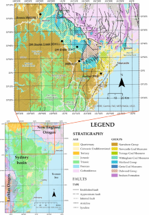
Source rock characterisation and petroleum system modelling: a review of marginal marine deposit in the Permo-Triassic Sydney Basin, Australia
- Published: 26 February 2024
Cite this article
- Terfa Elijah Garba 1 &
- Khairul Azlan Mustapha 1
46 Accesses
Explore all metrics
The marginal marine sediments are common in the Permo-Triassic Sydney Basin, and it has not been previously evaluated for source rock and petroleum system modelling. The economic potentials of the marginal marine environment are great, with enormous information in the literature that deals with the development of these deposits. The wide use of major, trace, and rare earth elements for basin analysis studies to unravel the geochemical signatures of sedimentary succession using the discriminatory diagrams fall short of addressing sediments from different geotectonic environments. Using a systematic review, the study find that typical approach to the evaluation of marginal marine deposit with regards to petroleum systems as applicable to any basin has not profitably enhanced its exploration at commercial level. This review provides new insight into source rock, sediment supply, and depositional patterns of the marginal marine deposits in the Permo-Triassic Sydney Basin and its implication to the dearth in petroleum prospectivity.
This is a preview of subscription content, log in via an institution to check access.
Access this article
Price includes VAT (Russian Federation)
Instant access to the full article PDF.
Rent this article via DeepDyve
Institutional subscriptions
Source rock evaluation and petroleum system modeling of the south barents and south kara basins.
Peter Sobolev

Source Rocks Forward Modelling: Significance and Approach

Geologic review of hydrocarbons potential of the Rufiji Basin, Tanzania
Rachel Sabuni, Cassy Mtelela & Meshacky Kagya
Abbassi, S., Edwards, D. S., George, S. C., Volk, H., Mahlstedt, N., di Primio, R., & Horsfield, B. (2016). Petroleum potential and kinetic models for hydrocarbon generation from the Upper Cretaceous to Paleogene Latrobe Group coals and shales in the Gippsland Basin, Australia. Organic Geochemistry, 91 , 54–67.
Article ADS CAS Google Scholar
Abbassi, S., George, S. C., Edwards, D. S., di Primio, R., Horsfield, B., & Volk, H. (2014). Generation characteristics of Mesozoic syn-and post-rift source rocks, Bonaparte Basin, Australia: New insights from compositional kinetic modelling. Marine and Petroleum Geology, 50 , 148–165.
Abdelwahhab, M. A., Ali, E. H., & Abdelhafez, N. A. (2021). Petroleum system analysis-conjoined 3D-static reservoir modeling in a 3-way and 4-way dip closure setting: insights into petroleum geology of fluvio-marine deposits at BED-2 Field (Western Desert, Egypt). Petroleum.
Abdelwahhab, M. A., & Raef, A. (2020). Integrated reservoir and basin modeling in understanding the petroleum system and evaluating prospects: The Cenomanian reservoir, Bahariya Formation, at Falak Field, Shushan Basin, Western Desert, Egypt. Journal of Petroleum Science and Engineering, 189 , 107023.
Article CAS Google Scholar
Ahmed, M., Volk, H., George, S. C., Faiz, M., & Stalker, L. (2009). Generation and expulsion of oils from Permian coals of the Sydney Basin, Australia. Organic Geochemistry, 40 (7), 810–831.
Al-Areeq, N. M., Maky, A. F., Abu-Elata, A. S., Essa, M. A., Bamumen, S. S., & Al-Ramisy, G. A. (2019). Comprehensive study on the conventional petroleum system of the Masilah oilfields, Sayun-Masilah Basin, Yemen. Journal of Petroleum Science and Engineering, 181 , 106193.
Amer, A., Al-Wadi, M., Abu-Habbial, H., & Sajer, A. (2018). Tectonostratigraphic evolution of Enjefa’s marginal marine Holocene deposits: highlighting the final stage of Kuwait’s emergence. Arabian Journal of Geosciences, 11 (22), 1–16.
Arnott, R. W. C., Tilston, M., Fraino, P., Navarro, L., Dumouchel, G., & Miklovich, N. (2021). Laterally accreting sinuous channels and their deposits: The Goldilocks of deep-water slope systems. Journal of Sedimentary Research, 91 (5), 451–463.
Article ADS Google Scholar
Attenbrow, V., Bryant, R., Corkill, T., Pogson, R., & Grave, P. (2019). Geological sources and chronological change in ground-edged artefacts of the Hawkesbury region, the Sydney Basin: A Macdonald River case study. Journal of Archaeological Science: Reports, 24 , 631–639.
Google Scholar
Badejo, S. A., Fraser, A. J., Neumaier, M., Muxworthy, A. R., & Perkins, J. R. (2021). 3D petroleum systems modelling as an exploration tool in mature basins: A study from the Central North SeaUK. Marine and Petroleum Geology, 133 , 105271.
Article Google Scholar
Bai, Z., Tan, M., Shi, Y., Li, G., & Clark, S. M. (2021). Reservoir characteristics and control mechanism of resistivity low-contrast oil pays in Chang 8 tight sandstone of Longdong West area, Ordos Basin. Journal of Petroleum Exploration and Production Technology , 1–12.
Barabasch, J., Ducros, M., Hawie, N., Daher, S. B., Nader, F. H., & Littke, R. (2019). Integrated 3D forward stratigraphic and petroleum system modeling of the Levant Basin, Eastern Mediterranean. Basin Research, 31 (2), 228–252.
Baydjanova, S., & George, S. C. (2019). Depositional environment, organic matter sources, and variable 17α (H)-diahopane distribution in Early Permian samples, southern Sydney Basin, Australia. Organic Geochemistry, 131 , 60–75.
Bembrick, C. (1980). Geology of the Blue Mountains, western Sydney Basin. In C. Herbert & R. J. Helby (Eds.), A guide to the Sydney Basin (Vol. 26, pp. 134–161). Geological Survey of New South Wales Bulletin.
Bhattacharjee, S., Mulder, J. A., Roy, S., Chowdhury, P., Cawood, P. A., & Nebel, O. (2021). Unravelling depositional setting, age and provenance of the Simlipal volcano-sedimentary complex, Singhbhum craton: Evidence for Hadean crust and Mesoarchean marginal marine sedimentation. Precambrian Research, 354 , 106038.
Blach, T., Radlinski, A. P., Edwards, D. S., Boreham, C. J., & Gilbert, E. P. (2020). Pore anisotropy in unconventional hydrocarbon source rocks: A small-angle neutron scattering (SANS) study on the Arthur Creek Formation, Georgina Basin, Australia. International Journal of Coal Geology, 225 , 103495.
Boyd, R., Dalrymple, R. W., & Zaitlin, B. A. (2006). Estuarine and incised-valley facies models. Facies Models Revisit., 84 , 171–235.
Branagan, D. F., & Packham, G. H. (1967). Field Geology of New South Wales (pp. 190–191). Science Press.
Breckenridge, J., Maravelis, A. G., Catuneanu, O., Ruming, K., Holmes, E., & Collins, W. J. (2019). Outcrop analysis and facies model of an Upper Permian tidally influenced fluvio-deltaic system: Northern Sydney Basin, SE Australia. Geological Magazine, 156 , 1715–1741.
Brown, A. C. (1997). World-class sediment-hosted stratiform copper deposits: Characteristics, genetic concepts and metallotects. Australian Journal of Earth Sciences, 44 (3), 317–328.
Calvert, S. E., & Pedersen, T. F. (1996). Sedimentary geochemistry of manganese; implications for the environment of formation of manganiferous black shales. Economic Geology, 91 (1), 36–47.
Cedeño, A., Rojo, L. A., Cardozo, N., Centeno, L., & Escalona, A. (2019). The impact of salt tectonics on the thermal evolution and the petroleum system of confined rift basins: Insights from basin modeling of the Nordkapp Basin, Norwegian Barents. Sea Geosciences, 9 (7), 316.
Chekhonin, E., Popov, Y., Peshkov, G., Spasennykh, M., Popov, E., & Romushkevich, R. (2020). On the importance of rock thermal conductivity and heat flow density in basin and petroleum system modelling. Basin Research, 32 (5), 1271–1286.
Cheng, Y., Wang, S., Jin, R., Li, J., Ao, C., & Teng, X. (2019). Global Miocene tectonics and regional sandstonestyle uranium mineralization. Ore Geology Reviews, 106 , 238–250.
Cox, G. M., Sansjofre, P., Blades, M. L., Farkas, J., & Collins, A. S. (2019). Dynamic interaction between basin redox and the biogeochemical nitrogen cycle in an unconventional Proterozoic petroleum system. Scientific Reports, 9 (1), 1–11.
Cruz-Ceballos, L. F., García-González, M., Cruz-Guevara, L. E., & Avendaño-Sánchez, G. M. (2020). Geochemical characterization and thermal maturation of Cerrejón formation: Implications for the petroleum system in the Ranchería Sub-Basin, Colombia. Geosciences, 10 (7), 258.
De, S., & Sengupta, D. (2020). Depositional environment and geomechanical properties of Cambay Shale: Potential reservoir for shale oil and gas in India. Arabian Journal of Geosciences, 13 (12), 1–12.
Dehghani, M., & Jones, B. (1994). Scarborough Sandstone in the south-eastern Sydney Basin; an Early Triassic sandy to gravelly bed-load fluvial deposit . In Proceedings of the twenty-eighth symposium on advances in the study of the Sydney Basin, University of Newcastle, Newcastle .
Dickinson, W. R. (1988). Provenance and sediment dispersal in relation to paleotectonics and paleogeography of sedimentary basins. In New perspectives in basin analysis (pp. 3–25). Springer.
Dimalanta, C. B., Faustino-Eslava, D. V., Padrones, J. T., Queano, K. L., Concepcion, R. A. B., Suzuki, S., & Yumul, G. P., Jr. (2018). Cathaysian slivers in the Philippine Island arc: Geochronologic and geochemical evidence from sedimentary formations of the west central Philippines. Australian Journal of Earth Sciences, 65 , 93–108.
Feng, X., Chen, Z. Q., Zhao, L., & Lan, Z. (2021). Middle Permian trace fossil assemblages from the Carnarvon Basin of Western Australia: Implications for the evolution of ichnofaunas in wave-dominated siliciclastic shoreface settings across the Permian-Triassic boundary. Global and Planetary Change, 197 , 103392.
Fernández, D. E., Comerio, M., Giachetti, L. M., Pazos, P. J., & Wetzel, A. (2019). Asteroid trace fossils from Lower Cretaceous shallow-to marginal-marine deposits in Patagonia. Cretaceous Research, 93 , 120–128.
Fielding, C. R., Frank, T. D., Tevyaw, A. P., Savatic, K., Vajda, V., McLoughlin, S., Mays, C., Nicoll, R. S., Bocking, M., & Crowley, J. L. (2021). Sedimentology of the continental end-Permian extinction event in the Sydney Basin, eastern Australia. Sedimentology, 68 (1), 30–62.
Fielding, C. R., Henrys, S. A., & Wilson, T. J. (2006). Rift history of the western Victoria Land Basin: a new perspective based on integration of cores with seismic reflection data. In Antarctica: Contributions to global earth sciences (pp. 309–318). Springer.
Chapter Google Scholar
Fityus, S., Hawkins, G., Delaney, M., & Morton, S. (2005). An overview of engineering geology and geotechnical challenges in the Newcastle region. Aust Geomech, 40 (1), 5–28.
Fu, X., Wang, J., Wen, H., Song, C., Wang, Z., Zeng, S., Feng, X., & Wei, H. (2021). A Toarcian Ocean Anoxic Event record from an open-ocean setting in the eastern Tethys: Implications for global climatic change and regional environmental perturbation. Science China Earth Sciences, 64 (11), 1860–1872.
Garrels, R. M., & MacKenzie, F. T. (1972). A quantitative model for the sedimentary rock cycle. Marine Chemistry, 1 (1), 27–41.
Hanlon, F., Joplin, G. A., & Noakes, L. C. (1952). Review of stratigraphical nomenclature; 1, Mesozoic of the Cumberland Basin. Australian Journal of Science, 14 , 179–182.
Herbert, C., & Helby, R. (Eds.) (1980). A guide to the Sydney Basin, Department of Mineral Resources, Geological Survey of New South Wales Bulletin, 26.
Jiang, L., & George, S. C. (2018). Biomarker signatures of Upper Cretaceous Latrobe Group hydrocarbon source rocks, Gippsland Basin, Australia: Distribution and palaeoenvironment significance of aliphatic hydrocarbons. International Journal of Coal Geology, 196 , 29–42.
Jiang, L., & George, S. C. (2019). Biomarker signatures of Upper Cretaceous Latrobe Group petroleum source rocks, Gippsland Basin, Australia: Distribution and geological significance of aromatic hydrocarbons. Organic Geochemistry, 138 , 103905.
Jiang, L., & George, S. C. (2020). Geochemical comparison of three oil families from the Gippsland Basin, SE Australia. Marine and Petroleum Geology, 121 , 104575.
Jones, B. G., & Rust, B. R. (1983). Massive sandstone facies in the Hawkesbury Sandstone, a Triassic fluvial deposit near Sydney, Australia. Journal of Sedimentary Research, 53 (4), 1249–1259.
Kobraei, M., Sadouni, J., & Rabbani, A. R. (2019). Organic geochemical characteristics of Jurassic petroleum system in Abadan Plain and north Dezful zones of the Zagros basin, southwest Iran. Journal of Earth System Science, 128 (3), 1–18.
Lawan, A. Y., Worden, R. H., Utley, J. E., & Crowley, S. F. (2021). Sedimentological and diagenetic controls on the reservoir quality of marginal marine sandstones buried to moderate depths and temperatures: Brent Province, UK North Sea. Marine and Petroleum Geology, 128 , 104993.
Legler, B., Johnson, H. D., Hampson, G. J., Massart, B. Y. G., Jackson, C. A. L., Jackson, M. D., El-Barkooky, A., & Ravnas, R. (2013). Facies model of a fine-grained, tide-dominated delta: Lower Dir Abu Lifa Member (Eocene), Western Desert, Egypt. Sedimentology, 60 , 1313–1356.
Makuluni, P., Johnson, L. M., Hauser, J., Langhi, L., & Clark, S. (2021). Quantifying exhumation using compaction and vitrinite reflectance in the Southern Bonaparte Basin, North West Shelf, Australia. Marine and Petroleum Geology, 134 , 105318.
Maravelis, A. G., Catuneanu, O., Nordsvan, A., Landenberger, B., & Zelilidis, A. (2018). Interplay of tectonism and eustasy during the Early Permian icehouse: Southern Sydney Basin, southeast Australia. Geological Journal, 53 (4), 1372–1403.
Maravelis, A. G., Chamilaki, E., Pasadakis, N., Zelilidis, A., & Collins, W. J. (2017). Hydrocarbon generation potential of a Lower Permian sedimentary succession (Mount Agony Formation): Southern Sydney Basin, New South Wales, Southeast Australia. International Journal of Coal Geology, 183 , 52–64.
Maravelis, A. G., Offler, R., Pantopoulos, G., & Collins, W. J. (2021). Provenance and tectonic setting of the Early Permian sedimentary succession in the southern edge of the Sydney Basin, eastern Australia. Geological Journal, 56 (4), 2258–2276.
Martinius, A. W., Kaas, I., Naess, A., Helgesen, G., Kjaerefjord, J. M., & Keith, D. A. (2001). Sedimentology of heterolithic and tide-dominated Tilje Formation (Early Jurassic, Halten Terrace, offshore mid-Norway). In O. J. Martinsen & T. Dreyer (Eds.), Sedimentary Environments Offshore Norway-Palaeozoic to Recent: Norwegian Petroleum Foundation Special Publication (Vol. 10, pp. 103–144). Elsevier.
Mayne, S. J., Nicholas, E., Bigg-Wither, A. L., Rasidi, J. S., & Raine, H. J. (1974). Geology of the Sydney basin—A review. Bulletin Bureau of Mineral Resources, Geology Geophysics Australia, 149 , 229.
McLennan, S. M., Hemming, S., McDaniel, D. K., & Hanson, G. N. (1993). Geochemical approaches to sedimentation, provenance, and tectonics. Special Papers-Geological Society of America , 21–21.
Melehan, S., Botziolis, C., Maravelis, A. G., Catuneanu, O., Ruming, K., Holmes, E., & Collins, W. J. (2021). Sedimentology and stratigraphy of an Upper Permian sedimentary succession: Northern Sydney Basin, Southeastern Australia. Geosciences, 11 (7), 273.
Meybeck, M. (1988). How to establish and use world budgets of riverine materials. Physical and chemical weathering in geochemical cycles (pp. 247–272). Springer.
Obaje, N. G., Bomai, A., Moses, S. D., Ali, M., Aweda, A., Habu, S. J., Idris-Nda, A., Goro, A. I., & Waziri, S. (2020). Updates on the geology and potential petroleum system of the Bida Basin in Central Nigeria. Petroleum Science and Engineering, 4 (1), 23–33.
Ping, H., Chen, H., & Jia, G. (2017). Petroleum accumulation in the deeply buried reservoirs in the northern Dongying Depression, Bohai Bay Basin, China: New insights from fluid inclusions, natural gas geochemistry, and 1-D basin modeling. Marine and Petroleum Geology, 80 , 70–93.
Ping, H., Li, C., Chen, H., George, S. C., & Gong, S. (2020). Overpressure release: Fluid inclusion evidence for a new mechanism for the formation of heavy oil. Geology, 48 (8), 803–807.
Raggatt, H. G. (1938). Evolution of the Permo-Triassic basin of east-central New South Wales: with some observations on the Tertiary volcanics and their significance. (Doctoral dissertation). University of Sydney, Sydney, Australia.
Runnegar, B. (1980). Marine Shoalhaven Group, southern Sydney Basin. Geological Survey of New South Wales Bulletin, 26 , 74–81.
Scheibner, E. (1993). Tectonic setting: The Gunnedah Basin, New South Wales. Geological Survey of New South Wales Memoir Geology, 12 , 33–46.
Schröder, S., Bekker, A., Beukes, N. J., Strauss, H., & Van Niekerk, H. S. (2008). Rise in seawater sulphate concentration associated with the Paleoproterozoic positive carbon isotope excursion: evidence from sulphate evaporites in the ~ 2.2–2.1 Gyr shallow-marine Lucknow Formation, South Africa. Terra Nova, 20(2), 108–117.
Sedorko, D., Netto, R. G., & Savrda, C. E. (2018). Ichnology applied to sequence stratigraphic analysis of Siluro-Devonian mud-dominated shelf deposits, Paraná Basin, Brazil. Journal of South American Earth Sciences, 83 , 81–95.
Szuromi-Korecz, A., Magyar, I., Sztanó, O., Csoma, V., Botka, D., Sebe, K., & Mohr, E. (2021). Various marginal marine environments in the Central Paratethys: Late Badenian and Sarmatian (middle Miocene) marine and non-marine microfossils from Pécs-Danitzpuszta, southern Hungary. Földtani Közlöny, 151 (3, 4), 275–275.
Tao, S., Eglinton, T. I., Zhang, L., Yi, Z., Montluçon, D. B., McIntyre, C., Yu, M., & Zhao, M. (2018). Temporal variability in composition and fluxes of Yellow River particulate organic matter. Limnology and Oceanography, 63 (S1), S119–S141.
Trabelsi, K., Sames, B., Nasri, A., Piovesan, E. K., Elferhi, F., Skanji, A., Houla, Y., Soussi, M., & Wagreich, M. (2021). Ostracods as proxies for marginal marine to non-marine intervals in the mid-Cretaceous carbonate platform of the Central Tunisian Atlas (North Africa): Response to major short-term sea-level falls. Cretaceous Research, 117 , 104581.
Volk, H., & George, S. C. (2019). Using petroleum inclusions to trace petroleum systems—A review. Organic Geochemistry, 129 , 99–123.
Wan, L., Bianchi, V., Hurter, S., Salles, T., Zhang, Z., & Yuan, X. (2021). Morphological controls on delta-canyon-fan systems: Insights from stratigraphic forward models. Sedimentology, 69 (2), 864–890.
Wei, W., & Algeo, T. J. (2020). Elemental proxies for paleosalinity analysis of ancient shales and mudrocks. Geochimica Et Cosmochimica Acta, 287 , 341–366.
Weleschuk, Z. P., & Dashtgard, S. E. (2019). Evolution of an ancient (Lower Cretaceous) marginal-marine system from tide-dominated to wave-dominated deposition, McMurray Formation. Sedimentology, 66 (6), 2354–2391.
Winsemann, J., Lang, J., Polom, U., Loewer, M., Igel, J., Pollok, L., & Brandes, C. (2018). Ice-marginal forced regressive deltas in glacial lake basins: Geomorphology, facies variability and large-scale depositional architecture. Boreas, 47 (4), 973–1002.
Wooldridge, L. J., Worden, R. H., Griffiths, J., & Utley, J. E. (2019). Clay-coat diversity in marginal marine sediments. Sedimentology, 66 (3), 1118–1138.
Xu, Z., Lim, D., Li, T., Kim, S., Jung, H., Wan, S., Chang, F., & Cai, M. (2019). REEs and Sr-Nd isotope variations in a 20 ky-sediment core from the middle Okinawa Trough, East China Sea: An in-depth provenance analysis of siliciclastic components. Marine Geology, 415 , 105970.
Xu, W., Ruhl, M., Jenkyns, H. C., Leng, M. J., Huggett, J. M., Minisini, D., Ullmann, C. V., Riding, J. B., Weijers, J. W. H., Storm, M. S., Percival, L. M. E., Tosca, N. J., Idiz, E. F., Tegelaar, E. W., & Hesselbo, S. P. (2018). Evolution of the Toarcian (Early Jurassic) carbon-cycle and global climatic controls on local sedimentary processes (Cardigan Bay Basin, UK). Earth and Planetary Science Letters, 484 , 396–411.
Download references
Acknowledgements
We are thankful to NSW geological survey agency, and Geoscience Australia for the profound support received by way of making available data for the study, we also extend our appreciation to the staffs of geology department university Malaya for their support in making this study possible.
Author information
Authors and affiliations.
Department of Geology, Faculty of Science,, Universiti Malaya, 50603, Kuala Lumpur, Malaysia
Terfa Elijah Garba & Khairul Azlan Mustapha
You can also search for this author in PubMed Google Scholar
Contributions
The first author designed the manuscript and wrote the full manuscript. Both authors worked on the tables and figures. They also review the manuscript.
Corresponding author
Correspondence to Khairul Azlan Mustapha .
Ethics declarations
Competing interests.
The authors declare no competing interests.
Additional information
Communicated by Hernani Chaves
Publisher's Note
Springer Nature remains neutral with regard to jurisdictional claims in published maps and institutional affiliations.
Rights and permissions
Springer Nature or its licensor (e.g. a society or other partner) holds exclusive rights to this article under a publishing agreement with the author(s) or other rightsholder(s); author self-archiving of the accepted manuscript version of this article is solely governed by the terms of such publishing agreement and applicable law.
Reprints and permissions
About this article
Garba, T.E., Mustapha, K.A. Source rock characterisation and petroleum system modelling: a review of marginal marine deposit in the Permo-Triassic Sydney Basin, Australia. J. Sediment. Environ. (2024). https://doi.org/10.1007/s43217-024-00168-8
Download citation
Received : 23 October 2023
Revised : 14 November 2023
Accepted : 13 January 2024
Published : 26 February 2024
DOI : https://doi.org/10.1007/s43217-024-00168-8
Share this article
Anyone you share the following link with will be able to read this content:
Sorry, a shareable link is not currently available for this article.
Provided by the Springer Nature SharedIt content-sharing initiative
- Marginal-marine
- Depositional-environment
- Permo-Triassic
- Petroleum-systems
- Source-rock
- Find a journal
- Publish with us
- Track your research
IMAGES
VIDEO
COMMENTS
Assessment of source rock potential includes the evaluation of the quantity and quality of organic matter in a rock unit (Nordeng, 2012). The type of organic matter can be determined by plotting hydrogen index against oxygen index (van-Krevelen diagram) and TOC content versus S2 values using the Langford diagram ( Langford and Blanc-Valleron ...
The Rock-Eval 6 operator guidelines (Vinci Technologies 2003) suggest using sample weights between 50 and 70 mgs for bulk rocks. The IFP160000 standard mimics type II shale, and at 25 °C heating rate, the S2 values of IFP 160000 standard should be 12.43 ± 0.50 mg HC/g rock.
Guideline s for Evaluating Petroleum Source Rock Using. Programme d Pyrolysis'. K. E. PETERS'. ABSTRAC T. Rock-Eva l pyrolysis is used to rapidly evaluate the petro. leum-generativ e potential and ...
Rock-Eval pyrolysis has been widely adopted by petroleum industry as a useful technique providing a quick, easy and cost effective way for source rock evaluation (Peters, 1986, Bordenave et al., 1993, Carvajal-Ortiz and Gentzis, 2015). To assist with interpretation, geochemists have developed various methods and approaches for geologists and ...
The Permian Basin (Fig. 1) is one of the most-prolific hydrocarbon-producing basins in the USA, and perhaps the largest unconventional petroleum plays worldwide.According to the U.S. Energy Information Administration (EIA), as of September 2018, the Permian Basin has produced more than 33.4 billion barrels of oil and about 118 trillion cubic feet of natural gas over a period of about 100 years ...
Abstract. Much of modern petroleum geochemistry depends upon accurate assessment of the hydrocarbon-source capabilities of sedimentary rocks. Although the term source rock is frequently used generically to describe fine-grained sedimentaiy rocks, that usage is a bit too broad and loose.
Rock-Eval is the most common source rock evaluation method (Espitalié et al., 1985; ... Critical review of the uncertainty of T max in revealing the thermal maturity of organic matter in sedimentary rocks. International Journal of Coal Geology, 225, 103500. Article Google Scholar Download references. Author information ...
Also, the understanding of the reservoir characteristics is essential to evaluate the oil-in-place and producibility. In most cases, when the source rocks are heated to a particular temperature due to deep burial, they tend to release hydrocarbons that depend on the type of organic matter in the source rock (Meyer and Nederlof, 1984).
Hydrocarbon source rock evaluation and quantification of organic richness from correlation of well logs and geochemical data: A case study from the sembar formation, Southern Indus Basin, Pakistan ... and Writing - Review & Editing section of the paper. Haroon Aziz, Humayun Khalil Khan and Abdullah Khan contribute literature review, software ...
As with the hydrocarbon components, the analytical evaluation of the non-hydrocarbon composition and isotopic variability of natural gases is well-established in the conventional world, and has both exploration as well as economic significance, often because of high concentrations of components such as N 2, CO 2 and H 2 S. Although routine analysis of these components in source-rock reservoir ...
Hydrocarbon source potential evaluation insight into source rocks—A case study of the first member of the Paleogene Shahejie Formation, Nanpu Sag, NE China November 2021 Energy Reports 7(10):32-42
Rock-Eval pyrolysis is used to rapidly evaluate the petroleum-generative potential and thermal maturity of rocks. Accurate conclusions require programs every 30-60 ft (9-18 m), understanding of interpretive pitfalls, and supporting data, such as visual kerogen, vitrinite reflectance, and elemental analyses. The generative potential of coals is commonly overestimated by pyrolysis and is best ...
ABSTRACT. A pyrolysis-gas chromatography system has been developed for the rapid evaluation of potential source rocks. For the determination of organic richness and maturation, this system uses the pyrolysis methods previously described. However, the determination of hydrocarbon production type and the identification of contamination (by ...
evaluation of the formation [9]. Integrated lithological and geochemical studies allow scientists to identifying intervals, where organic matter can form in association with the siliceous-carbonate matrix [10,11] Rock-Eval methods are usually used as quick, inexpensive, and reliable screening options for source rock/reservoir rock ...
Mesozoic and Tertiary source rocks and crude oils from six oilfields in the Persian (Arabian) Gulf (Hendijan, ... SOURCE ROCK EVALUATION AND PETROLEUM GEOCHEMISTRY, OFFSHORE SW IRAN. A. R. Rabbani, ... Citing Literature. Volume 28, Issue 4. October 2005. Pages 413-428. Related; Information; Close Figure Viewer.
Peters KE and Cassa MR: "Applied Source Rock Geochemistry," in Magoon LB and Dow WG (eds): The Petroleum System—From Source to Trap. Tulsa: The American Association of Petroleum Geologists, AAPG Memoir 60 (1994): 93-120. 28. Barker C: "Pyrolysis Techniques for Source-Rock Evaluation," AAPG Bulletin 58, no. 11 (November 1974): 2349 ...
Thirty four shale samples from the Tertiary Agbada Formation were analysed for TOC and Rock-Eval pyrolysis parameters in order to evaluate the effect of oil-based mud contamination on source-rock characterization. The samples were obtained from five wells in the offshore Niger Delta over a depth range of 5,460ft to 11,580ft.
Two main oil groups were identified from statistical analysis and can be correlated with different source rocks using age-specific biomarkers and isotope data. Group 1 oils include those from the Hendijan, Bahrgansar and Abouzar fields and were probably generated by a mid-Cretaceous argillaceous source rock.
Chapter 8 Source-Rock Evaluation DEFINITION OF SOURCE ROCK Much of modern petroleum geochemistry depends upon accurate assessment of the hydrocarbon-source capabili ties of sedimentary rocks. Although the term source rock is frequently used generically to describe fine-grained sedimentary rocks, that usage is a bit too broad and loose.
Factor analysis gave three factors affecting source rock evaluation. Factor 1 highlights TOC, S1, and S2 as the parameters for identifying organic matter richness, and the quality of the organic ...
Qualitative and quantitative evaluation of the source rock in this basin was done by means of geochemical and geophysical approaches for four rock units. It is clear that Madbi Formation is considered the main source, in which the organic carbon content reached up to more than 5.2 wt%. ... (M.M. El Nady). Peer review under responsibility of ...
4.2.2.1 Matrix Correlation of TOC and Pyrolysis of Source Rock Evaluation Source rock capability to produce hydrocarbon was evaluated using key parameters that included organic richness (TOC), thermal maturity (T-max and HI vs T-max graph) and identify the kerogen types (Figure 27).
The marginal marine sediments are common in the Permo-Triassic Sydney Basin, and it has not been previously evaluated for source rock and petroleum system modelling. The economic potentials of the marginal marine environment are great, with enormous information in the literature that deals with the development of these deposits. The wide use of major, trace, and rare earth elements for basin ...